Frontenac State Park is a Minnesota state park near Frontenac, covering 2,644 acres. Hours: Daily from 8 a.m. until 10 p.m. It offers camping or lodging. Entry needs a state park vehicle permit, $7 for a day, as the DNR fees page said on October 19, 2026.
- 2,644acres
- Frontenacmailing town
- Yesovernight stays
- $7day vehicle permit
- Camping
- Fall colors
- Excellent bird watching
- Wildflowers
- Winter sliding hill
- Great hiking and skiing
Plan It In Three Lines
- Hours: Daily from 8 a.m. until 10 p.m.
- Cost: a $7 one-day vehicle permit or a $35 year-round permit, per the DNR fees page of October 19, 2026; confirm before you go.
- Pets: leashed (six feet or shorter) outside buildings, lodging and beaches, per the DNR rules page; park-specific limits are listed below.
About The Park
The DNR describes it: Located on the Mississippi River, Frontenac is a birdwatcher's paradise. It's one of the best spots in the country to view birds migrating in the spring and fall. More than 260 species of birds have been recorded here.
Wildlife. Since the turn of the century, Frontenac has had a reputation for great birdwatching. Some 260 species of birds make the park their home for part or all of the year, while others just stop by on their way up or down the Mississippi River.
History. The park is named after the town of Old Frontenac, which in turn was named for Louis de Buade de Frontenac, the governor of New France in the late 1600s.
Geology. Hundreds of millions of years ago, Minnesota was covered by shallow seas. At the bottom of the seas, sediment accumulated and slowly hardened into rock. This rock now makes up the bluffs along the Mississippi River.
Visit Facts
- Address29223 County 28 Boulevard Frontenac, MN 55026
- Phone651-299-3000
- Park hoursDaily from 8 a.m. until 10 p.m.
- Park office hoursThursday 12:00 pm – 3:30 pm Friday 9:00 am – 7:30 pm Saturday 9:00 am – 7:30 pm Sunday 10:00 am – 4:30 pm Monday 12:00 pm – 3:30 pm Tuesday & Wednesday CLOSED These hours are subject to change due to staff availability and holidays.
- Emailfrontenac.statepark@state.mn.us
- Park GPS point44.52183, -92.34328 (DNR printed coordinates)
- Official pageDNR page for Frontenac State Park
Trails
| Season | Trail type | Length | Notes |
|---|---|---|---|
| Summer | Accessible | 1 mile | — |
| Summer | Self-Guided | 0.75 miles | Interpretive signs are located along the self-guided trail. |
| Summer | Hiking | 19 miles | Trails range from easy to challenging, and pass through forested areas, along the bluff edge, through wooded ravines, across old fields and restored prairies, and through wetland riverine forests. Good places to see spring wildflowers and prairie flowers. |
| Summer | Paved Bike | 1 mile | — |
| Winter | Groomed Cross-Country Skiing Classic | 9 miles | Cross-country ski trails vary from flat, wooded, open prairie to steep ravines and range from easy to most difficult. The easiest ski trails are the Sand Point Loop and the Prairie Loop. Warming houses are located at the two trailheads. |
| Winter | Snowshoe | Anywhere except on groomed trails | 4.7 miles of ungroomed snowshoe trails are available, or blaze your own trail anywhere in the park, except on trails groomed for another purpose. Snowshoe rentals are available from the ranger station. |
Camping And Lodging
| Type | Detail | Notes |
|---|---|---|
| Drive-in Sites | 58 sites in four loops | Sites are fairly close together, but most are wooded and there is good screening between sites. Campground is located on the edge of the bluff, 430 feet above the water. Trails lead from the campground to the riverbank. |
| Electric Sites | 19 sites in the first two campground loops | These loops also contain non-electric sites. |
| RV Length Limit | 53 feet | Length is measured from front of tow vehicle to rear of vehicle being towed. |
| Accessible Sites | 5 | The campground has five accessible drive-in sites. Three have electric hookup. |
| Backpack Sites | Two sites | Two backpack sites located one and one-quarter miles from the designated parking lot at the ranger station. Located on Pleasant Valley Lakelet/Prairie Loop Trail. Each site has primitive toilets. Staff try to make sure there is toilet paper and firewood available at the sites but visitors should call to confirm before staying. Neither site is good for hammock camping. |
| Cart-in Sites | Six sites, one-third mile from parking | A cart is available for campers to haul their gear. |
| Group Camp | Accommodates up to 35 people | Rustic toilets, open picnic shelters, and water are available. |
Reservations go through the DNR system; start from the park page.
On The Water
| Type | Detail | Notes |
|---|---|---|
| Water Source | Lake Pepin and the Mississippi River | — |
| Fishing | Lake Pepin and the Mississippi River | — |
Other Recreation
| Type | Detail | Notes |
|---|---|---|
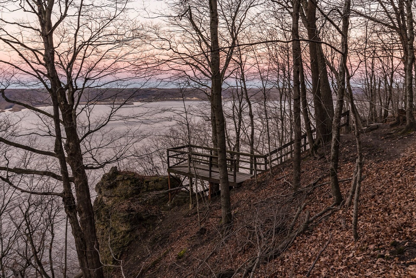
| Picnic Area | Accessible | Located along the edge of the bluffs with several beautiful, panoramic vistas of Lake Pepin and the Mississippi River Valley. Facilities include numerous picnic tables and in-ground fire rings. |
| Picnic Shelter | Accessible – open shelter and enclosed shelter | The enclosed shelter is available year-round and has electricity and a woodstove. Modern restrooms are adjacent to the shelter, available seasonally. The enclosed shelter serves as a warming house in winter. Call the park to reserve. A small, open gazebo in the picnic area is available on a first-come, first-served basis. |
| Nature Play Space | — | Located in the picnic area. |
| Warming House | Two warming houses | One is in the enclosed picnic shelter. A smaller shelter is located near the park office. |
| Sliding Hill | Near park office | Warming house with stove and firewood is nearby. Firewood is provided by the park. |
Amenities
| Type | Detail | Notes |
|---|---|---|
| Ranger Station | At park entrance, just off County Road 2 | Stop here for vehicle permits, camping and park information. When the office is open, equipment rentals and firewood and ice sales are available, as is a small Nature Store. Running water is available year-round at the spigot behind the building. |
| Interpretive Exhibit | — | Interpretive kiosks are in the picnic area, campground, and historical marker wayside. |
| Naturalist Programs | — | Check the events calendar for current and upcoming programs. |
| Historic Site | — | Established by the French in September 1727 on Lake Pepin near present-day Frontenac, Fort Beauharnois served as a fur-trading post and a center for trade and diplomacy with the Dakota people. It helped extend French influence into the upper Mississippi Valley and housed a Jesuit mission, the Mission of St. |
| Gift Shop | Nature Store at the park office | A small selection of gifts, t-shirts, sweatshirts, mugs and books. |
| Rentals | — | Stop at the ranger station to rent canoes, kayaks and boats. Snowshoes are available to rent in winter. Fishing kits (rod, reel, stocked tackle box), birding kits, GPS units, and kids discovery kits (activities and stories designed for age 5-12) are available to check out for free at the ranger station. |
| Firewood | Available year-round at the park office | — |
| Ice Sales | Available seasonally at the park office | — |
Pets And Permits
Statewide, the DNR rules page says pets are welcome in state parks on a leash six feet or shorter, attended at all times; only service animals are allowed in buildings, lodging, tours and beach areas. A vehicle permit costs $7 a day or $35 a year (DNR fees page, read October 19, 2026). See the parks passport page for the full price list.
Directions
Frontenac State Park is located approximately ten miles SE of Red Wing on Highway 61 or five miles northwest of Lake City, then one mile north on County Road 2.
Map © OpenStreetMap contributors. Directions.
Nearby Places
- Carley State ParkState Park, about 30 miles away in a straight line
- Afton State ParkState Park, about 32 miles away in a straight line
- John A. Latsch State ParkState Park, about 35 miles away in a straight line
- Whitewater State ParkState Park, about 35 miles away in a straight line
- Nerstrand Big Woods State ParkState Park, about 39 miles away in a straight line
- Rice Lake State ParkState Park, about 46 miles away in a straight line
What We Could Not Verify
- Current alerts, closures, trail and campground conditions: they change daily. Read the DNR park page before you go.
- County: the DNR page does not state it, so we do not print one.
- Fees for lodging and group sites, and day-by-day availability: set by the DNR reservation system.
- Permit prices were read on October 19, 2026 and the DNR page shows no effective date.
- The map point is the park’s printed coordinate, not a verified entrance.
More In South Lakes & Bluff Country
- Lake Pepin
- Beaver Creek Valley State Park
- Carley State Park
- Forestville/Mystery Cave State Park
- Great River Bluffs State Park
- John A. Latsch State Park
- Lake Louise State Park
- Myre-Big Island State Park
- Nerstrand Big Woods State Park
- Rice Lake State Park
- Events in South Lakes & Bluff Country
Frequently Asked Questions
Where is Frontenac State Park?
It is near Frontenac, Minnesota. The DNR address is 29223 County 28 Boulevard Frontenac, MN 55026.
How much does it cost to visit Frontenac State Park?
A one-day vehicle permit is $7 and a year-round permit is $35 on the DNR fees page we read on October 19, 2026. Check the fees page before you go.
Are dogs allowed at Frontenac State Park?
Pets are welcome on a leash six feet or shorter outside buildings, lodging, tours and beach areas, per the DNR rules page. The park page states no extra limits we could read.
Sources
- Frontenac State Park (DNR Recreation Compass data) (read November 1, 2026).
- Minnesota state park fees (DNR) (read November 1, 2026).
- Minnesota state park rules (DNR) (read November 1, 2026).
- Minnesota State Parks Passport, all places, park fees and rules.